Building the backbone of connectivity for plantations, rural developments, and urban centers.
We design robust infrastructure tailored to the unique demands of high-traffic plantation environments and expanding urban zones. Our approach focuses on durability, safety, and seamless integration with existing terrain.
Drawing from extensive field experience, our team understands the critical balance between cost-efficiency and long-term performance. We engineer roads that stand up to heavy machinery, tropical weather, and the demands of modern logistics.
Precision planning of horizontal and vertical alignments for heavy-duty hauling and transit. We optimize curve radii, grades, and sight distances to ensure safe, efficient transport routes that minimize fuel costs and vehicle wear.
Expert mapping and physical delineation of road boundaries, drainage corridors, and right-of-way (ROW) zones. Our comprehensive marking systems include signage, reflectors, and barrier placement to maximize safety for all road users.
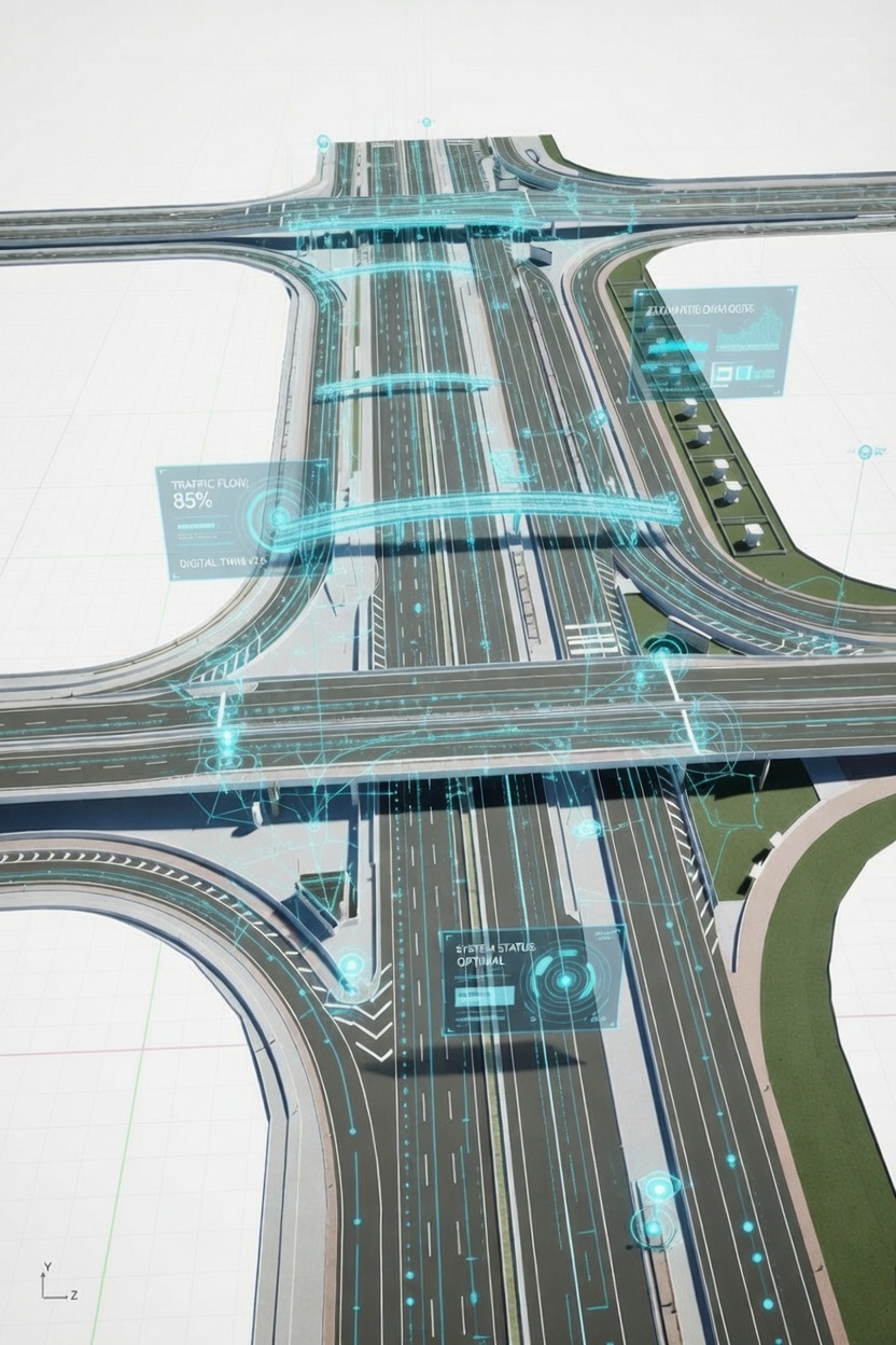
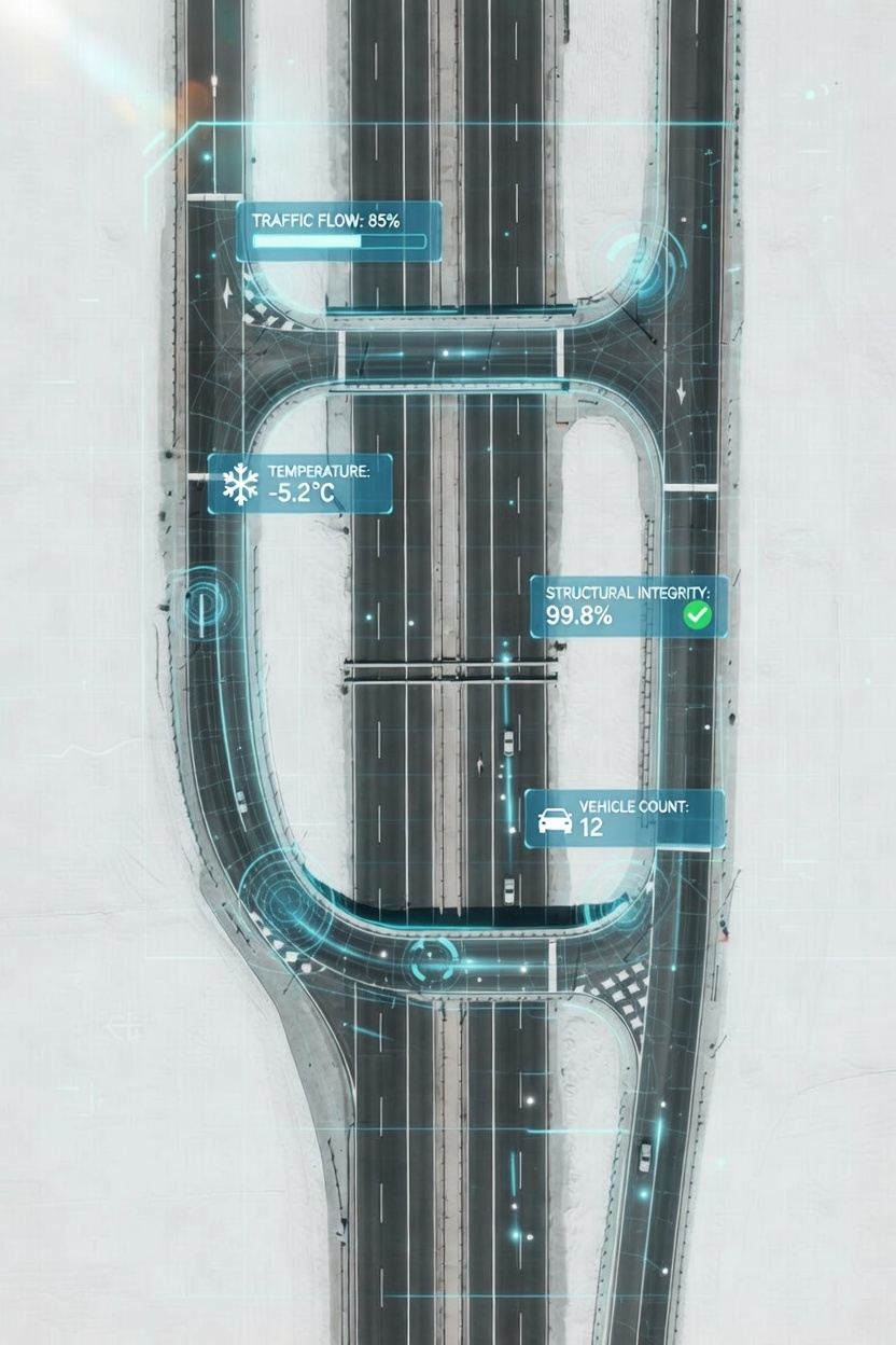
Development of custom digital twins and monitoring systems to track road health, maintenance cycles, and traffic flow in real-time. IoT sensors and AI analytics help predict maintenance needs before failures occur.
Engineered solutions to prevent erosion and ensure all-weather accessibility in tropical or rugged environments. We design culverts, retention systems, and surface treatments that handle extreme rainfall while protecting road integrity.
Our infrastructure design process leverages cutting-edge geospatial technology combined with time-tested engineering principles. Every project begins with comprehensive terrain analysis and ends with a fully documented digital asset.
Unlike traditional engineering firms, we combine decades of field experience in plantation and urban sectors with cutting-edge AI and Geospatial tools. This allows us to not only design your project but to develop the digital systems that manage it for years to come. From initial concept to long-term asset management, we deliver infrastructure solutions that perform reliably and adapt to your evolving needs.
